Welcome | About
Stourbridge | Glass | Town Tours | Can you help? | What's
on | Stourbridge Lion | Music
| Sport | Long
Lost friends | Pubs
Schools and Colleges | Shopping | Clubs
and Charities | Genealogy
| Stourbridge Area | Business
| Links | Lots
more stuff | Contact | Homepage
Stourbridge to Ironbridge bike ride - 50 miles
A superb bike ride to Ironbridge, Shropshire, the closest UNESCO World Heritage site to Stourbridge. Despite the distance, this wonderful route is not as difficult as you might imagine, taking in beautiful villages and mostly quiet country lanes. There are some off-road sections but the ride could be done on almost any type of bike, as long as your legs are up to it of course! But it is well within the capabilities of any reasonably fit cyclist.
There is so much to see and do in the Ironbridge area it attracts visitors from all over the world. Often describes as the "birthplace of the industrial revolution", Ironbridge gorge is home to no less than ten museums devoted to different aspects of life and industry in the area. Additionally, the gorge is a walker's and cyclist's paradise, with tracks and pathways running alongside the River Severn gorge.
The route begins at the car park of Mary Stevens park in Norton, postcode DY8 2AB. Key points along the route are listed below. Please click on the photos for a larger version. Back to Stourbridge area page
| |
|
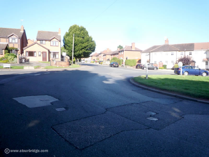 |
From Mary Stevens Park car park, turn left and cycle along South Road, going past the Gigmill pub on the left and Swan Pool playing fields on the right. Cycle up the hill past the Crematorium on your left and go straight over the island (photo) at the top into Dunsley Road. Carry on along Dunsley Road then down the steep hill, part way down the hill the road bends to the left, but you need to take Gibbet Lane, straight on. Take care at this junction. |
 |
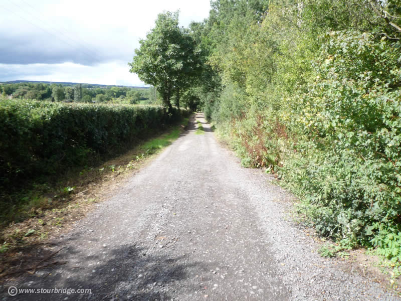
Cycle past the Round Hill water treatment works, then turn into the road on the right, where you will see access to a footpath through the fence to the left, into the woods. Years ago Gibbet Lane was open to traffic, it's amazing how quickly it has returned to nature, as it is just a narrow track now (photo). |
 |
Eventually
Gibbet Lane reaches the main A449 Kidderminster to Wolverhampton Road
(photo), where you turn right (with care). Carry on along the A449 till
you reach the traffic lights at the junction with the Bridgnorth Road,
turn left. |
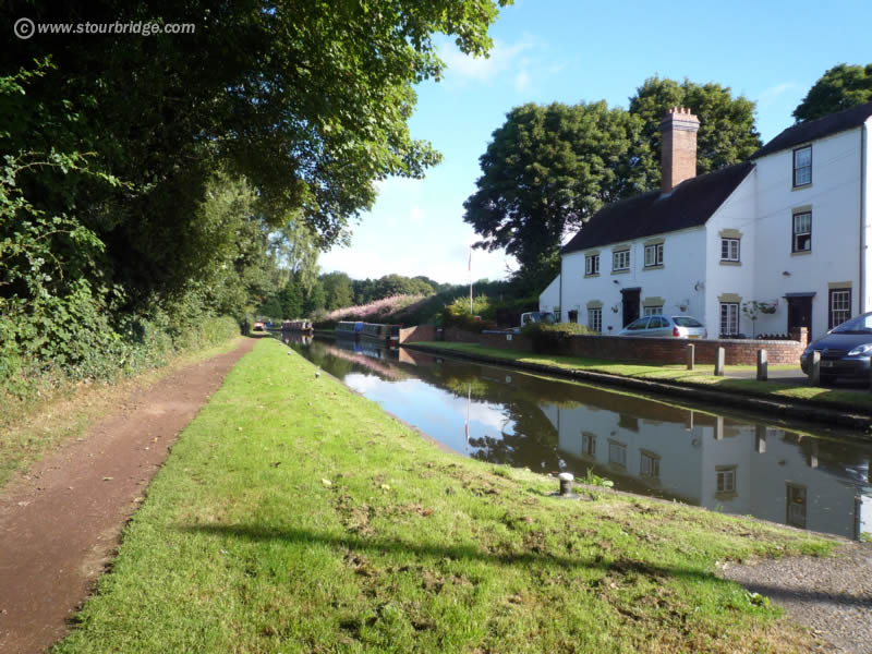 |
After a few yards cross the road and go along the small road that runs alongside the Bridgenorth Road to join the Staffordshire and Worcestershire canal towpath. Begin cycling along the towpath with the old buildings on your right (photo). |
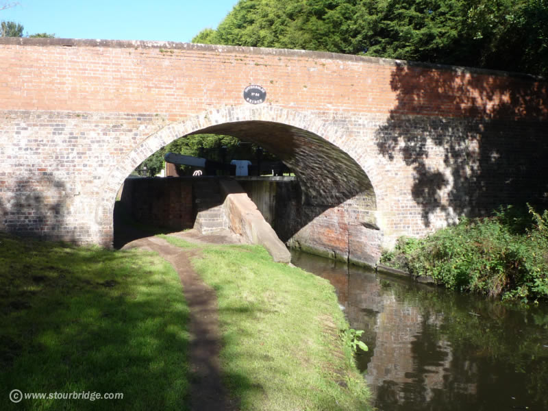 |
Continue along the towpath for a mile or two till you reach the Gothersley Bridge (photo). Leave the towpath after the bridge and continue along the lane that runs alongside it. |
 |
After a couple of hundred yards you reach a small bridge over a brook (photo), turn left, then right a few yards later. |
 |
Carry on along this lane for another mile or so with woodland on your left, till it reaches Chester Road (photo), where you turn right. After a few hundred yards take the second turning on the left, Highgate Road, going past Enville Golf club. At the top of a gentle climb stay on the road, do not take the road that goes straight on at the bend. Carry on along Gospel Ash Road past Wolverhampton Airport, on your left, |
 |
Eventually you reach the junction with Six Ashes Road at the Royal Oak pub (photo). Cross over by the pub carpark, then after 75 yards turn right then immediate left. Continue along this lane untill you join the main Dudley to Bridgnorth road B4176. |
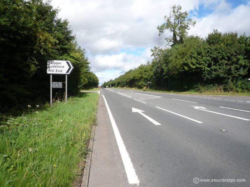 |
You will join this road at an angle, take care, it's one of the few fast stretches of road, but you are only on it for half a mile or so. Take the right turn for Upper Ludstone (photo) - a much quieter country lane! |
 |
Carry on down the hill till you get to the Boycott Arms (photo), turn right immediatetly in front of the pub, cross a small crossroads, after which you arrive at the main Wolverhampton to Bridgnorth Road A454. |
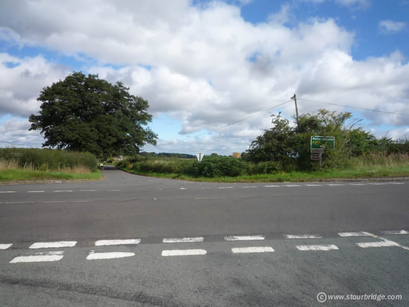 |
Take care crossing the Wolverhampton to Bridgnorth road (photo), go straight over. |
 |
This long straight country lane (photo) is a pleasure to cycle along, continue over two sets of small crossroads, about 3 miles. |
 |
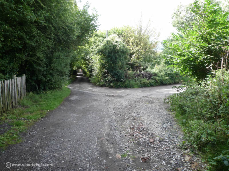
Eventually you reach this junction
with these cottages straight ahead (photo). Take the left turn, then
first right towards the beautiful village of Badger. |
 |
Badger
is a delightful village with chocolate box cottages, church and duckpond
(photo).
With the pond on your right take the road right towards the village
of Beckbury, a couple of miles away. |
 |
Beckbury is another charming village (photo), cycle right through it, past the church on your left and the Seven Stars pub further on and out into the open countryside. Cycle for a couple of miles along this lane, taking the second left turning. |
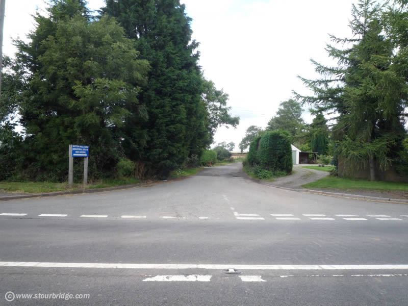 |
This brings you out on to the main Telford to Bridgnorth road, turn right then left a few yards down the road (photo). The blue sign says "Sutton Hall Farm Industrial Estate HGV Access" - take this lane. |
 |
Continue along this track (photo) and do not take the left turn. After a while it goes downhill. |
 |
Be careful to take this right turn (photo) as you go down the hill, and continue cycling through the woods, The track is a little rough but my mate had no problems with it on his racer! |
 |
After
a mile or two you reach the Coalport road on a bend (photo), continue
down the hill to the River Severn. |
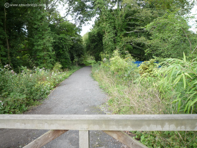 |
At the bottom of the hill you are spoilt for choice which way to go Ironbridge, as there is a road and two cycle/walking routes. We took the middle one (photo), known as the Silkin Way. |
 |
It is then a straightforward
ride into Ironbridge along the Severn Gorge. |
 |
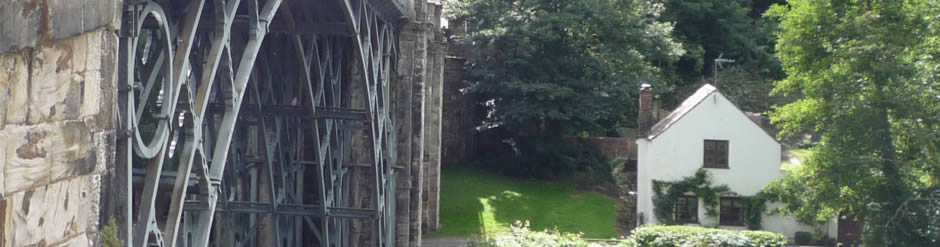
View of Ironbridge from the famous bridge itself. |
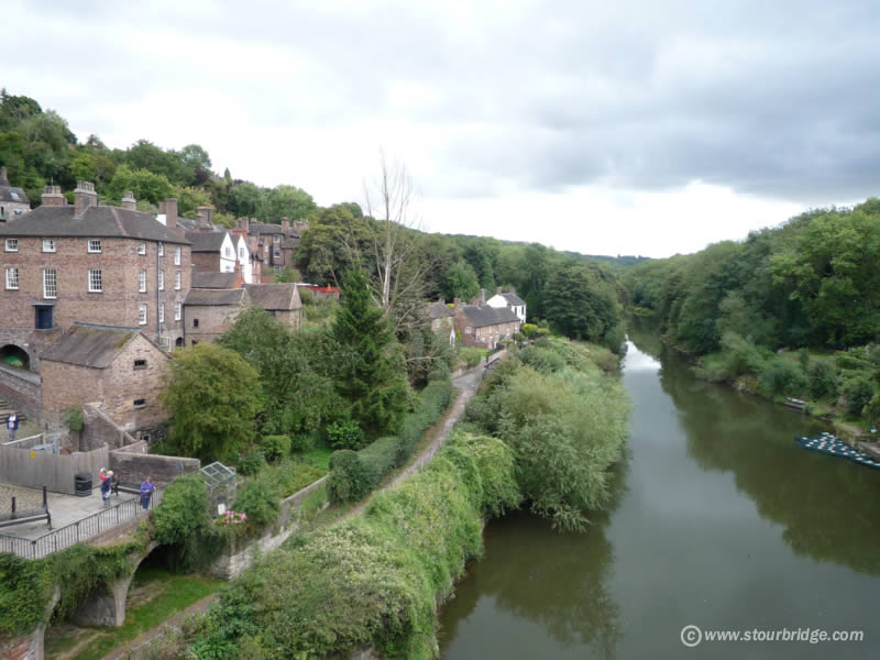 |
View up the river from the bridge, The journey home is reversal of these directions, although there are numerous other routes you could take if you prefer. We hope you enjoy the trip, do contact us, especially if you have any problems with my directions! |
|
|
Stourbridge Lion | Music | Sport | Long Lost Friends | Clubs and Charities | Pubs | Schools and Colleges
Genealogy | Stourbridge Area | Business | Links | Lots more stuff | Contact | Homepage